Saturday, December 11, 2021

SCENERY VAL D'AOSTA NORTH/SOUTH-AREA + MATTERHORN PARK 2.0

Very wide scenery, 3500 sq km. It includes a large area of Val d'Aosta, with all the main valleys and the city of Aosta entirely rebuilt in 3D, with monuments, buildings, stations, sports centers, archaeological areas ...
and the LIMW regional airport. Coming soon for X-Plane 11 and also when the XP12 version is released.
Some screenshots :

Friday, July 2, 2021

INDEPENDENT DAY - GOOD DISCOUNT ON ALL SCENARIES

From tomorrow 3 July and until Monday 5 ... 30% discounts on all scenaries.
Also a good opportunity for those who love Dolomites.
over 50% discount if they buy all 5 packages....LINK

Friday, May 28, 2021

Features new Matterhorn Park vs.2

This second version of Matterhorn Park has been greatly expanded with many more details. From about 800 sq km it will now be 2000 sq km. Many valleys have been added both in Italy (Ajas, Gressoney, Alagna-Sesia, Macugnaga) in Switzerland, the Zermatt valley increased and the Zinal valley added. Added Monte Rosa with Refuges (Gnifetti, Q.Sella, Capanna Margherita) Added many polygons / textures taken from photographs in the Switzerland area. Improved all sites (Helipad) added Chamois and Gressoney airports. Most of the houses in Cervinia and Zermatt have been redone. Improved some textures of the Matterhorn. Added various shelters both on the Italian and Swiss side. Ultimately a totally revised and corrected version.

Super Zoom!

Friday, April 30, 2021

Matterhorn Park vers.2

I'm working for a few weeks on the second version of Matterhorn Park. Added the Val Tournenche with Chamois-airport (LICHA) and several villages also in addition to Tasch (Zermatt). Replaced many buildings in both Breuil-Cervinia and Zermatt. Added many polygons-textures and redone some textures of the Mattherorn with a higher definition, also for Dent d'Herens. Lots of details (lakes, churches, villages ...). A practically renewed version.

Thursday, February 11, 2021

Machupicchu Avalable!

MACHUPICCHU National Park

This scenery for X-Plane 11 is dedicated to an archaeological area of South America: the Machupicchu National park.
It is a very suggestive and touristic area, a UNESCO heritage site and visited by 1 million tourists.
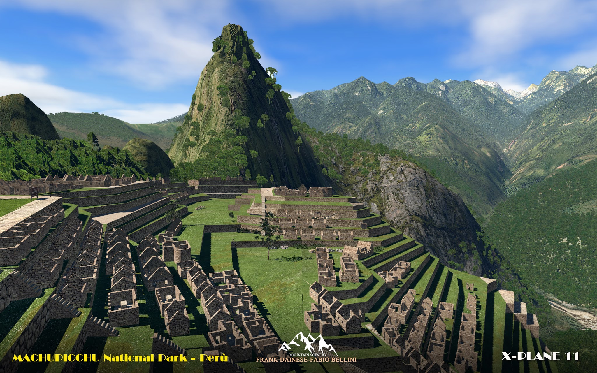
It is an archaeological site of INKAS civilization located in Peru, in Urubamba valley at 2430 mt of altitude.
The location is universally known for its impressive and original ruins, it's the third largest archaeological site in the world.
included in the degree -14 -073.

The whole territory was reconstructed on a photographic basis.
The village (Aguas Calientes,S.Teresa) are reproduced with typical buildings, hotels, residences ...
All the vegetation has been mapped and reproduced in 3D.
1 Airport grass-runways in S.Teresa distreect
3 heliports at the respective tourist sites and archaeological site.
Reconstructed with 3D models the area archaeological (INKAS) with 4K textures processed from photos.
This scenery is only suitable for VFR flight, only with a "visual flight".
ICAO codes: XLPMH MachuPicchu Aiport
HLPMH [H] Machu_Picchu Heliport
HLMPC [H] Machu_Picchu Area archeologica
HLPAC [H] Aguas Calientes
Screenshots: Archaelogical Area and Aguas Calientes Village